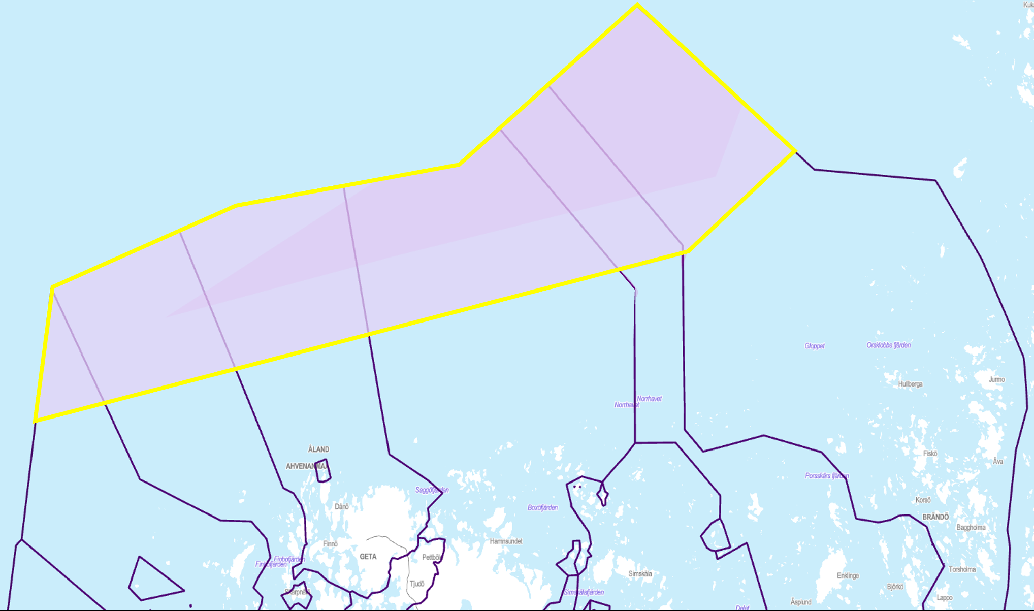
The northern energy area
As a result of project development within Sunnanvind, the area north of Åland that was originally identified as suitable for offshore wind power in Åland’s maritime spatial plan has changed. The southern areas marked in the maritime spatial plan are at this stage not under development due to restrictions imposed by the Finnish Defence Forces.
At the initiation of the Sunnanvind project in autumn 2021, the planning area was based on the areas identified as suitable for offshore wind power in the Maritime Spatial Plan for Åland. However, at the stage when the Participation and Information Plan was launched, in February 2024, it was decided by the project group to modify the planning area to what was at the time considered the maximum potential extent.
The area at the stage of the Participation and Information Plan, February 2024.
Further development
As the project has progressed, the area has been further refined. By relocating the existing shipping route, a contiguous zone of approximately 1,200 km² has been established, situated farther offshore. This not only allows for greater energy production potential but also enhances the project's economic viability for Åland. A larger survey area provides flexibility for future adjustments and increases the project's attractiveness to the market.
The area of 1200 km² could in theory accommodate up to around 300 wind turbines. Fully deployed with 15 MW turbines, the total installed capacity would reach 3–4 GW, generating an estimated 20 TWh of electricity annually. This corresponds to roughly 25–30% of Finland’s current electricity production.
The area potential is based on the following factors:
- Excellent geographical location
- Size
- Generally favourable wind conditions
- The position between two markets with growing renewable energy demands
- Manageable distances for connections: 75 km to the Finnish coast and 120 km to the Swedish coast
Åland's maritime spatial plan
The foundation for all development within Sunnanvind is Åland’s Maritime Spatial Plan (MSP), approved by the Government of Åland on 18 March 2021. The MSP outlines potential usage of Åland’s public waters, which are administered by the Government of Åland, not including privately owned waters. As a non-binding, guiding document, the MSP allows expansion of the investigated area as the project evolves.
Maritime spatial planning involves managing and organizing the use of maritime areas in a strategic and purposeful manner. Social, economic, and environmental interests, among others, are to be considered during the planning process.
In accordance with Directive 2014/89/EU of the European Parliament and of the Council on the establishment of a framework for maritime spatial planning, all member states are required to develop a maritime spatial plan. The purpose of the MSP is to promote sustainable growth in maritime economies, sustainable development in maritime areas, and sustainable use of marine resources. As Åland has legislative authority in matters of energy, planning, construction, and the environment, the Government of Åland fulfilled its obligation by developing an MSP for its public waters.
During the preparation of Åland's MSP, various intended uses for the maritime areas were taken into account. Areas of significant natural, cultural, and environmental value were identified. Additionally, maritime areas suitable for offshore wind power production were identified based on multiple criteria. The Åland’s MSP includes a total of six energy areas, covering a combined area of 1007 km².
The maritime spatial plan is available on the Government of Åland’s GIS-platform.


